Salamanca Maps and Orientation
(Salamanca, Castilla y León, Spain)
Capital of the Salamanca province, this city is best described as being on the western side of central Spain, located within the autonomous region of Castilla y León (Castile and Leon). The famous university city of Salamanca is filled with history and magical architecture, which is at its best within the Old Centre, on the northern banks of the Tormes River.
The Plaza Mayor forms the very core of Old Town Salamanca and was built between the years of 1729 and 1755, being one of the grandest and most lavish plazas that you will likely encounter anywhere in Spain. This part of the city lends itself to walking, with a good choice of accommodation and restaurants being based between the Plaza Mayor and the Tormes River.
Maps and Orientation of the City
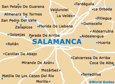
For public transport in Salamanca, you will find that the railway station lies directly to the north-east of the Plaza Mayor, while the bus station is to the north-west. If you are spending time in the Old Town and feeling a little bit lost, then pick up a free map at the tourist office on the Plaza Mayor. Alternatively, maps of Salamanca can be obtained from most good hotels and newsagents.
- Almenara De Tormes - 19 km / 12 miles (30 minutes, north-west)
- Avila - 106 km / 66 miles (one hour and 40 minutes, south-east)
- Calvarrasa De Arriba - 10 km / 6 miles (15 minutes, south-east)
- Canillas De Abajo - 27 km / 17 miles (45 minutes, south-west)
- Florida De Liebana - 16 km / 10 miles (25 minutes, north-west)
- Gomecello - 20 km / 12 miles (30 minutes, north-east)
- La Orbada - 26 km / 16 miles (40 minutes, north-east)
- La Vellés - 16 km / 10 miles (25 minutes, north)
- Miranda De Azan - 10 km / 6 miles (15 minutes, south)
- Morille - 21 km / 13 miles (30 minutes, south)
- Pitiegua - 26 km / 16 miles (40 minutes, north-east)
- San Pelayo De Guarena - 30 km / 19 miles (45 minutes, north-west)
- Terradillos - 19 km / 12 miles (30 minutes, south-east)
- Valdunciel - 15 km / 9 miles (25 minutes, north)
- Zarapicos - 22 km / 14 miles (35 minutes, north-west)
Map of Spain

Map of Salamanca